- Communications satellite
- Military
- NATO 4B
- NORAD 22921
- 1993-076A
- Inclined geosynchronous
Current orbit
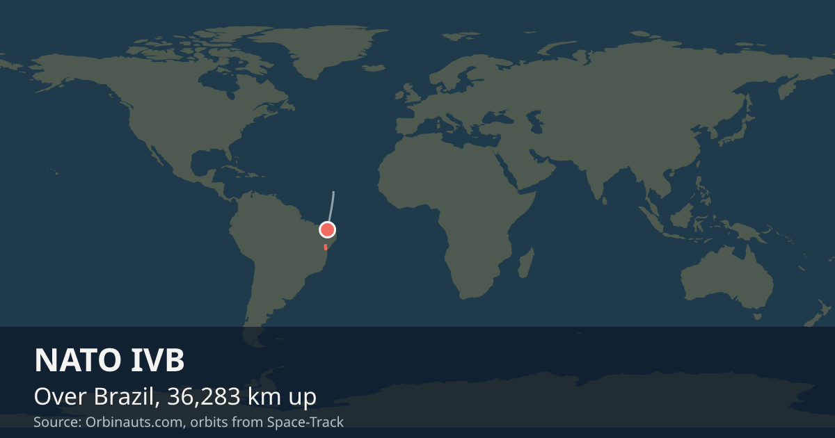 View on live map
Orbit began over the Atlantic Ocean
Orbit ends over the Atlantic Ocean
Sunlit since
Enters the Earth’s shadow
In view from you
Nobody watches NATO IVB go over, but a receiver still asks whether it is above the horizon. Say where you are and this card answers.
Your position is rounded to about a kilometre and sent only to the Orbinauts API, to find the pass.
No brightness has been published for NATO IVB, so it is not a naked-eye satellite and no city page carries pass times for it. Nothing here estimates one.
Seeing it
There is nothing to go outside for: it is too faint for the naked eye. What reaches you from it reaches a dish or an antenna, not an eye.
Timeline
- Launch
Launched, on the day GCAT records. Source
Summary
Over the Atlantic Ocean LIVE
Where is NATO IVB?
At 4:34:49 AM UTC NATO IVB was over the Atlantic Ocean (13° N, 29.9° W), 36,292 km up, moving at 3.06 km/s and in sunlight.
What is NATO IVB?
A communications satellite in an inclined geosynchronous orbit, in space since Dec 8, 1993.
Can I see NATO IVB?
No, not with the naked eye: no brightness has been published for NATO IVB, and nothing here estimates one; the dishes and receivers on the ground use its signals instead.
General
- Operator
- North Atlantic Treaty Organization
- State
- North Atlantic Treaty Organization
- Built by
- British Aerospace
- What it is
- Communications satellite
- Military
- Yes: a defence organisation flies it
- Launched
- Mass
- about 1.4 t
- Operating
- Orbit class
- Inclined geosynchronous
From GCAT, Jonathan McDowell’s general catalogue, licensed CC BY 4.0: the operator, the state, the manufacturer, what it is for, that a defence organisation flies it, the launch day, the mass, and whether it is operating. The orbit class is read from its current elements.
Latest orbital data
- Position received
- 4:34 AM UTC
- Station time (UTC)
- 4:34 AM UTC
- Latitude / longitude
- 13° N, 29.9° W
- Altitude
- 36,292 km
- Speed
- 3.06 km/s (11,002 km/h)
- Course
- north-east
- Light
- In sunlight until 1:58 AM UTC
- Inclination
- 13°
- Orbital period
- 1,461.6 minutes
- Orbits per day
- 0.99
- This orbit
- 36,277 to 36,294 km
- In shadow
- 33 minutes of each orbit
- In view from
- Within 7,960 km of the point below it
- Elements epoch
- Nov 7, 2026, 10:52 PM, 1 day old
- Source
- Position from Space-Track orbital elements of Nov 7, 2026, 10:52 PM, 1 day old.
No operator publishes an ephemeris for NATO IVB, so every position here comes from its orbital elements.
In orbit
- Close approaches
- No close approach to NATO IVB has been reported publicly in the past thirty days.
From Space-Track’s public conjunction messages; the latest report was issued Nov 8, 2026, 2:43 PM, 9 hours old. Only approaches serious enough to be reported publicly are listed: within three days and, for two bodies near the Earth, closer than a kilometre with a chance of a collision above 1 in 10,000, the level at which NASA moves the ISS.
Launched with
NATO IVB shares its launch, 1993-076, with one other body the catalogue lists in orbit.
| Body | What it is |
|---|---|
| DELTA 2 R/B(2) | Rocket body |
Read from the international designators of the US catalogue: the year and the launch number every piece of one launch shares. A body that has come down is no longer listed.
Beside the others
| Satellite | Typical altitude | Orbital period | Mass | In space since |
|---|---|---|---|---|
| NATO IVB | 36,277 to 36,294 km | 1,462 minutes | about 1.4 t | 1993 |
| Hispasat 30W-6 | 35,786 to 35,786 km | 1,436 minutes | about 6.1 t | 2018 |
| Amazonas Nexus | 35,786 to 35,786 km | 1,436 minutes | about 4.1 t | 2023 |
| ARSAT-1 | 35,786 to 35,786 km | 1,436 minutes | about 3 t | 2014 |
| Astra 1N | 35,786 to 35,786 km | 1,436 minutes | about 5.3 t | 2011 |
| Hotbird 13F | 35,786 to 35,786 km | 1,436 minutes | about 4.5 t | 2022 |
Data and API
The current elements from Space-Track as an OMM object, epoch Nov 7, 2026, 10:52 PM, 1 day old.
{
  "OBJECT_NAME": "NATO 4B",
  "OBJECT_ID": "1993-076A",
  "EPOCH": "2026-11-07T22:52:52.101984",
  "MEAN_MOTION": 0.98520095,
  "ECCENTRICITY": 0.00019951,
  "INCLINATION": 12.9819,
  "RA_OF_ASC_NODE": 0.2745,
  "ARG_OF_PERICENTER": 272.9545,
  "MEAN_ANOMALY": 95.0953,
  "EPHEMERIS_TYPE": 0,
  "CLASSIFICATION_TYPE": "U",
  "NORAD_CAT_ID": 22921,
  "ELEMENT_SET_NO": 999,
  "REV_AT_EPOCH": 12003,
  "BSTAR": 0,
  "MEAN_MOTION_DOT": -0.00000226,
  "MEAN_MOTION_DDOT": 0
}