- Earth-watching satellite
- NORAD 39084
- 2013-008A
- Low Earth orbit
Current orbit
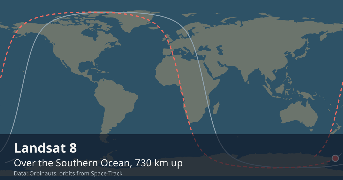 View on live map
Orbit began over Greenland
Orbit ends over Canada
In the Earth’s shadow since
Back in sunlight
In view from you
Nobody watches Landsat 8 go over, but a receiver still asks whether it is above the horizon. Say where you are and this card answers.
Your position is rounded to about a kilometre and sent only to the Orbinauts API, to find the pass.
No brightness has been published for Landsat 8, so it is not a naked-eye satellite and no city page carries pass times for it. Nothing here estimates one.
Seeing it
There is nothing to go outside for: it is too faint for the naked eye. What it is up there for reaches the ground as pictures and measurements, not as a light in the sky.
Altitude
One reading a day, worked out from the elements Space-Track publishes.
Timeline
- Launch
Launched on Atlas V from Vandenberg. Source
Summary
Over the Baltic Sea LIVE
Where is Landsat 8?
At 8:07:21 PM UTC Landsat 8 was over the Baltic Sea (55.1° N, 19.3° E), 711 km up, moving at 7.51 km/s and in the Earth’s shadow.
What is Landsat 8?
A satellite that watches the Earth in low Earth orbit, in space since Feb 11, 2013.
Can I see Landsat 8?
No, not with the naked eye: no brightness has been published for Landsat 8, and nothing here estimates one; what people use is its pictures and measurements of the Earth.
General

- Launched
- Watches
- The land: the Earth’s surface in visible, near-infrared, shortwave-infrared and thermal light
- Full picture of the Earth
- Every 16 days of land, or every 8 together with Landsat 9
- Operator
- NASA and the US Geological Survey, which runs it and publishes the pictures
- Mass
- about 2.8 t
- Typical altitude
- 702 to 703 km
- Speed
- about 7.5 km/s (27,000 km/h)
Latest orbital data
- Position received
- 8:07 PM UTC
- Station time (UTC)
- 8:07 PM UTC
- Latitude / longitude
- 55.1° N, 19.3° E
- Altitude
- 711 km
- Speed
- 7.51 km/s (27,022 km/h)
- Course
- north
- Light
- In the Earth’s shadow until 8:07 PM UTC
- Inclination
- 98.2°
- Orbital period
- 98.8 minutes
- Orbits per day
- 14.57
- This orbit
- 699 to 701 km
- In shadow
- 34 minutes of each orbit
- In view from
- Within 1,960 km of the point below it
- Elements epoch
- Sep 18, 2026, 6:40 AM, 13 hours old
- Source
- Position from Space-Track orbital elements of Sep 18, 2026, 6:40 AM, 13 hours old.
No operator publishes an ephemeris for Landsat 8, so every position here comes from its orbital elements.
In orbit
- Close approaches
- Close approaches to Landsat 8 are not available right now. Try again in a few minutes.
- Losing to drag
- Landsat 8 is falling about 1 m a day, read from the last 2 days of samples.
The Landsat programme
Orbinauts also tracks:
Data and API
The current elements from Space-Track as an OMM object, epoch Sep 18, 2026, 6:40 AM, 13 hours old.
{
  "OBJECT_NAME": "LANDSAT 8",
  "OBJECT_ID": "2013-008A",
  "EPOCH": "2026-09-18T06:40:58.301184",
  "MEAN_MOTION": 14.57101025,
  "ECCENTRICITY": 0.00013247,
  "INCLINATION": 98.2216,
  "RA_OF_ASC_NODE": 330.2664,
  "ARG_OF_PERICENTER": 94.6901,
  "MEAN_ANOMALY": 265.4449,
  "EPHEMERIS_TYPE": 0,
  "CLASSIFICATION_TYPE": "U",
  "NORAD_CAT_ID": 39084,
  "ELEMENT_SET_NO": 999,
  "REV_AT_EPOCH": 71145,
  "BSTAR": 0.000050204514,
  "MEAN_MOTION_DOT": 0.00000181,
  "MEAN_MOTION_DDOT": 0
}