- Earth-watching satellite
- NORAD 38771
- 2012-049A
- Low Earth orbit
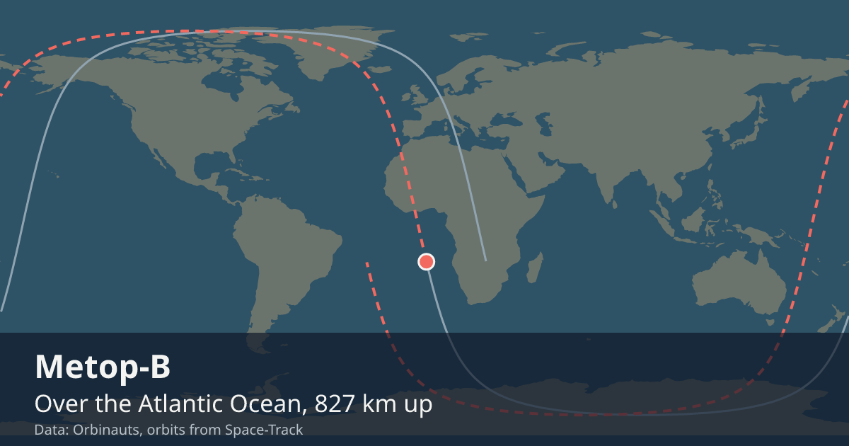
Current orbit
 View on live map
Orbit began over Greenland
Orbit ends over Greenland
Sunlit since
Enters the Earth’s shadow
In view from you
Nobody watches Metop-B go over, but a receiver still asks whether it is above the horizon. Say where you are and this card answers.
Your position is rounded to about a kilometre and sent only to the Orbinauts API, to find the pass.
Even at its closest, Metop-B is too faint to see with the naked eye from anywhere on Earth, so no city page carries pass times for it.
Seeing it
There is nothing to go outside for: it is too faint for the naked eye. What it is up there for reaches the ground as pictures and measurements, not as a light in the sky.
Altitude
One reading a day, worked out from the elements Space-Track publishes.
Timeline
- Launch
Launched on Soyuz-2.1a from Baikonur. Source
Summary
Over the Pacific Ocean LIVE
Where is Metop-B?
At 8:06:56 PM UTC Metop-B was over the Pacific Ocean (30.2° N, 163° W), 823 km up, moving at 7.45 km/s and in sunlight.
What is Metop-B?
A satellite that watches the Earth in low Earth orbit, in space since Sep 17, 2012.
Can I see Metop-B?
No, not with the naked eye: even at its closest, Metop-B is too faint to see from anywhere on Earth; what people use is its pictures and measurements of the Earth.
General
- Launched
- Watches
- The whole Earth: temperature and humidity through the atmosphere, winds over the oceans, and the air’s ozone
- Full picture of the Earth
- Twice a day, over every point of the Earth
- Operator
- EUMETSAT, Europe’s meteorological satellite agency
- Took over from
- Metop-A, as the primary Metop satellite, on Apr 24, 2013
- Mass
- about 4.1 t
- Typical altitude
- 818 to 823 km
- Speed
- about 7.44 km/s (26,800 km/h)
Latest orbital data
- Position received
- 8:06 PM UTC
- Station time (UTC)
- 8:06 PM UTC
- Latitude / longitude
- 30.2° N, 163° W
- Altitude
- 823 km
- Speed
- 7.45 km/s (26,802 km/h)
- Course
- south
- Light
- In sunlight until 8:49 PM UTC
- Inclination
- 98.6°
- Orbital period
- 101.3 minutes
- Orbits per day
- 14.21
- This orbit
- 815 to 820 km
- In shadow
- 28 minutes of each orbit
- In view from
- Within 2,150 km of the point below it
- Elements epoch
- Sep 18, 2026, 7:35 AM, 12 hours old
- Source
- Position from Space-Track orbital elements of Sep 18, 2026, 7:35 AM, 12 hours old.
No operator publishes an ephemeris for Metop-B, so every position here comes from its orbital elements.
In orbit
- Close approaches
- Close approaches to Metop-B are not available right now. Try again in a few minutes.
- Losing to drag
- Metop-B is falling less than a metre a day, read from the last 2 days of samples.
The Metop programme
Orbinauts also tracks:
Data and API
The current elements from Space-Track as an OMM object, epoch Sep 18, 2026, 7:35 AM, 12 hours old.
{
  "OBJECT_NAME": "METOP-B",
  "OBJECT_ID": "2012-049A",
  "EPOCH": "2026-09-18T07:35:23.428896",
  "MEAN_MOTION": 14.21459658,
  "ECCENTRICITY": 0.00034046,
  "INCLINATION": 98.641,
  "RA_OF_ASC_NODE": 310.9154,
  "ARG_OF_PERICENTER": 83.4939,
  "MEAN_ANOMALY": 276.6626,
  "EPHEMERIS_TYPE": 0,
  "CLASSIFICATION_TYPE": "U",
  "NORAD_CAT_ID": 38771,
  "ELEMENT_SET_NO": 999,
  "REV_AT_EPOCH": 72649,
  "BSTAR": 0.000036126638,
  "MEAN_MOTION_DOT": 3.6e-7,
  "MEAN_MOTION_DDOT": 0
}