- Pioneer
- NORAD 29
- 1960-002B
- Low Earth orbit
Current orbit
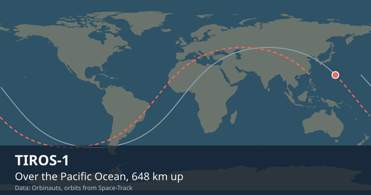 View on live map
Orbit began over the Atlantic Ocean
Orbit ends over the Atlantic Ocean
Sunlit since
Enters the Earth’s shadow
In view from you
Nobody watches TIROS-1 go over, but a receiver still asks whether it is above the horizon. Say where you are and this card answers.
Your position is rounded to about a kilometre and sent only to the Orbinauts API, to find the pass.
Even at its closest, TIROS-1 is too faint to see with the naked eye from anywhere on Earth, so no city page carries pass times for it.
Seeing it
There is nothing to go outside for: it is too faint for the naked eye. It is still up there all the same, going round as it has since it was launched.
Altitude
One reading a day, worked out from the elements Space-Track publishes.
Timeline
- Launch
Launched on Thor from Cape Canaveral. Source
- End of mission
Its mission ended.
Summary
Over the Atlantic Ocean LIVE
Where is TIROS-1?
At 8:07:22 PM UTC TIROS-1 was over the Atlantic Ocean (35.3° S, 38.9° W), 628 km up, moving at 7.55 km/s and in sunlight.
What is TIROS-1?
One of the pioneers of spaceflight in low Earth orbit, in space since Apr 1, 1960; its mission ended in 1960.
Can I see TIROS-1?
No, not with the naked eye: even at its closest, TIROS-1 is too faint to see from anywhere on Earth; what it is now is a relic of the first years in orbit.
General

- Launched
- Ended
- Remembered for
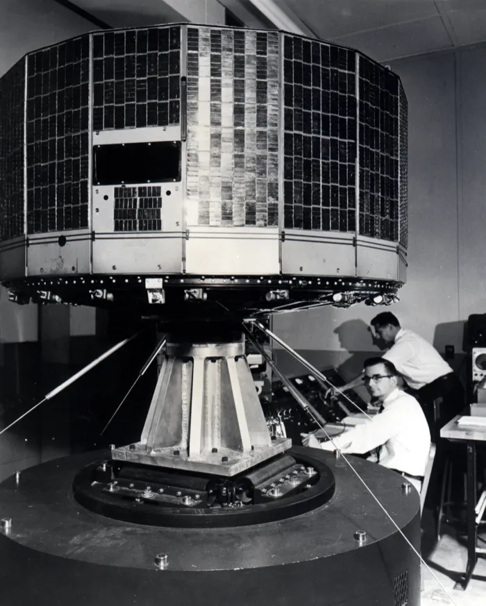
- Being the world’s first successful weather satellite, which gave forecasters their first view of clouds forming around the globe
- Operator
- NASA, from its Goddard Space Flight Center; RCA built it
- Size
- a drum 1.07 m across
- Mass
- 122.5 kg
- Typical altitude
- 617 to 649 km
- Speed
- about 7.54 km/s (27,100 km/h)
Latest orbital data
- Position received
- 8:07 PM UTC
- Station time (UTC)
- 8:07 PM UTC
- Latitude / longitude
- 35.3° S, 38.9° W
- Altitude
- 628 km
- Speed
- 7.55 km/s (27,191 km/h)
- Course
- north-east
- Light
- In sunlight until 8:17 PM UTC
- Inclination
- 48.4°
- Orbital period
- 97.4 minutes
- Orbits per day
- 14.79
- This orbit
- 618 to 650 km
- In shadow
- 31 minutes of each orbit
- In view from
- Within 1,810 km of the point below it
- Elements epoch
- Sep 18, 2026, 4:08 AM, 15 hours old
- Source
- Position from Space-Track orbital elements of Sep 18, 2026, 4:08 AM, 15 hours old.
No operator publishes an ephemeris for TIROS-1, so every position here comes from its orbital elements.
In orbit
- Close approaches
- Close approaches to TIROS-1 are not available right now. Try again in a few minutes.
- Losing to drag
- TIROS-1 is falling about 1 m a day, read from the last 2 days of samples.
Data and API
The current elements from Space-Track as an OMM object, epoch Sep 18, 2026, 4:08 AM, 15 hours old.
{
  "OBJECT_NAME": "TIROS 1",
  "OBJECT_ID": "1960-002B",
  "EPOCH": "2026-09-18T04:08:01.559328",
  "MEAN_MOTION": 14.78871116,
  "ECCENTRICITY": 0.00226302,
  "INCLINATION": 48.3783,
  "RA_OF_ASC_NODE": 302.7058,
  "ARG_OF_PERICENTER": 308.4291,
  "MEAN_ANOMALY": 51.4591,
  "EPHEMERIS_TYPE": 0,
  "CLASSIFICATION_TYPE": "U",
  "NORAD_CAT_ID": 29,
  "ELEMENT_SET_NO": 999,
  "REV_AT_EPOCH": 55589,
  "BSTAR": 0.000065045304,
  "MEAN_MOTION_DOT": 0.0000027,
  "MEAN_MOTION_DDOT": 0
}