- Earth-watching satellite
- GOES-17
- NORAD 43226
- 2018-022A
- Geostationary
Current orbit
 View on live map
One orbit takes a day, as long as the Earth takes to turn, so GOES-17 keeps above 89.5° W of the equator and never crosses the sky.
It never rises or sets
GOES-17 turns with the Earth, standing over one longitude of the equator. From anywhere it can be seen at all it is up day and night, in the same direction, so there is no pass to wait for.
No brightness has been published for GOES-17, so it is not a naked-eye satellite and no city page carries pass times for it. Nothing here estimates one.
Seeing it
There is nothing to wait for: it never crosses the sky. From the half of the Earth it stands over it keeps the same point day and night, and from the other half it never rises at all.
Timeline
- Launch
Launched on Atlas V from Cape Canaveral. Source
Summary
Over the Pacific Ocean LIVE
Where is GOES-17?
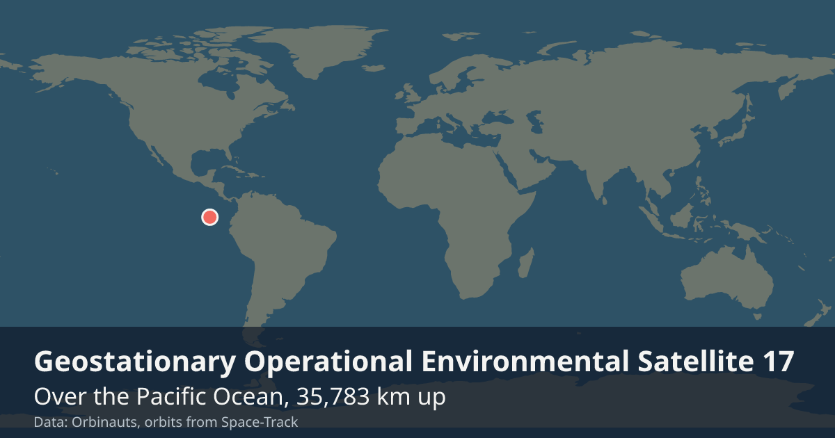
At 8:06:59 PM UTC GOES-17 was over the Pacific Ocean (1° N, 89.5° W), 35,783 km up, standing over one longitude of the equator and in sunlight.
What is GOES-17?
A satellite that watches the Earth in geostationary orbit, in space since Mar 1, 2018.
Can I see GOES-17?
No, not with the naked eye, and it never crosses the sky: GOES-17 stands over 89.5° W of the equator; what people use is its pictures and measurements of the Earth.
General

- Launched
- Watches
- The Western Hemisphere, when in service: clouds, storms, lightning, wildfires and the Sun
- Full picture of the Earth
- Every 10 minutes when in service, though a cooling fault loses some infrared images on nights near the equinoxes
- Operator
- NOAA, the US National Oceanic and Atmospheric Administration
- Role
- An on-orbit backup, kept in storage over 89.5° W
- Took over from
- GOES-15, as GOES West, on Feb 12, 2019
- Handed over to
- GOES-18, as GOES West, on Jan 4, 2023
- Mass
- about 5.2 t
- Typical altitude
- 35,786 to 35,786 km
- Speed
- about 3.07 km/s (11,100 km/h)
Latest orbital data
- Position received
- 8:06 PM UTC
- Station time (UTC)
- 8:06 PM UTC
- Latitude / longitude
- 1° N, 89.5° W
- Altitude
- 35,783 km
- Speed
- 3.08 km/s (11,070 km/h)
- Course
- Stands over 89.5° W
- Light
- In sunlight until 5:17 AM UTC
- Inclination
- 1.2°
- Orbital period
- 1,436.1 minutes
- Orbits per day
- 1
- This orbit
- 35,784 to 35,791 km
- In view from
- Within 7,940 km of the point below it
- Elements epoch
- Sep 18, 2026, 4:34 AM, 15 hours old
- Source
- Position from Space-Track orbital elements of Sep 18, 2026, 4:34 AM, 15 hours old.
No operator publishes an ephemeris for GOES-17, so every position here comes from its orbital elements.
In orbit
- Close approaches
- Close approaches to GOES-17 are not available right now. Try again in a few minutes.
The GOES programme
Orbinauts also tracks:
Data and API
The current elements from Space-Track as an OMM object, epoch Sep 18, 2026, 4:34 AM, 15 hours old.
{
  "OBJECT_NAME": "GOES 17",
  "OBJECT_ID": "2018-022A",
  "EPOCH": "2026-09-18T04:34:37.808832",
  "MEAN_MOTION": 1.00271816,
  "ECCENTRICITY": 0.0000815,
  "INCLINATION": 1.17,
  "RA_OF_ASC_NODE": 84.1394,
  "ARG_OF_PERICENTER": 124.9835,
  "MEAN_ANOMALY": 127.1678,
  "EPHEMERIS_TYPE": 0,
  "CLASSIFICATION_TYPE": "U",
  "NORAD_CAT_ID": 43226,
  "ELEMENT_SET_NO": 999,
  "REV_AT_EPOCH": 3135,
  "BSTAR": 0,
  "MEAN_MOTION_DOT": -0.00000187,
  "MEAN_MOTION_DDOT": 0
}