- Earth-watching satellite
- ALOS-2
- NORAD 39766
- 2014-029A
- Low Earth orbit
- Naked-eye
Current orbit
 View on live map
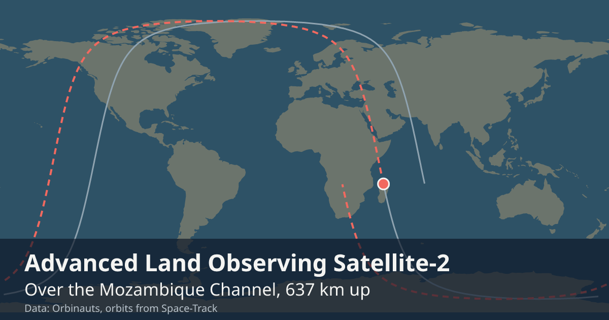
Orbit began over the Greenland Sea
Orbit ends over Greenland
Sunlit since
Enters the Earth’s shadow
Passes over you
Say where you are and your own next passes appear here, the first drawn across your sky.
Your position is rounded to about a kilometre and sent only to the Orbinauts API, to find the pass.
Meanwhile, the next visible pass over three cities:
- LondonNo visible pass in the next 10 days
- New York CityNo visible pass in the next 10 days
- SydneyNo visible pass in the next 10 days
How to see it
It crosses the sky as a steady point of light, no brighter than a faint star, a few minutes from one horizon to the other and never blinking. Its orbit keeps it over the line between day and night, so the hour after sunset and the hour before sunrise are the times to look, under as dark a sky as you can find. It can be seen from anywhere on Earth.
Passes over: Hamburg, Kyiv, Dubai, Bangkok, Osaka, San Francisco, Córdoba, Casablanca, every city
Altitude
One reading a day, worked out from the elements Space-Track publishes.
Timeline
- Launch
Launched on H-IIA from Tanegashima. Source
Summary
Over the United States of America LIVE
Where is ALOS-2?
At 8:06:31 PM UTC ALOS-2 was over the United States of America (34.8° N, 116.2° W), 635 km up, moving at 7.54 km/s and in sunlight.
What is ALOS-2?
A satellite that watches the Earth in low Earth orbit, in space since May 24, 2014.
Can I see ALOS-2 tonight?
Yes: ALOS-2 can be seen with the naked eye when it passes over you in a dark sky, after dusk or before dawn, as a steady light that crosses the sky in a few minutes.
General
- Launched
- Watches
- The Earth’s surface by L-band radar, day and night and in any weather: disasters, forests and the movements of the Earth’s crust
- Full picture of the Earth
- Over the same ground every 14 days
- Operator
- JAXA, the Japan Aerospace Exploration Agency, which calls it Daichi-2
- Mass
- about 2.1 t
- Typical altitude
- 630 to 632 km
- Speed
- about 7.54 km/s (27,100 km/h)
Latest orbital data
- Position received
- 8:06 PM UTC
- Station time (UTC)
- 8:06 PM UTC
- Latitude / longitude
- 34.8° N, 116.2° W
- Altitude
- 635 km
- Speed
- 7.54 km/s (27,158 km/h)
- Course
- south
- Light
- In sunlight until 8:46 PM UTC
- Inclination
- 97.9°
- Orbital period
- 97.3 minutes
- Orbits per day
- 14.79
- This orbit
- 627 to 629 km
- In shadow
- 35 minutes of each orbit
- In view from
- Within 1,830 km of the point below it
- Elements epoch
- Sep 18, 2026, 6:28 AM, 13 hours old
- Source
- Position from Space-Track orbital elements of Sep 18, 2026, 6:28 AM, 13 hours old.
No operator publishes an ephemeris for ALOS-2, so every position here comes from its orbital elements.
In orbit
- Close approaches
- Close approaches to ALOS-2 are not available right now. Try again in a few minutes.
- Losing to drag
- ALOS-2 is falling about 4 m a day, read from the last 2 days of samples.
Data and API
The current elements from Space-Track as an OMM object, epoch Sep 18, 2026, 6:28 AM, 13 hours old.
{
  "OBJECT_NAME": "ALOS 2",
  "OBJECT_ID": "2014-029A",
  "EPOCH": "2026-09-18T06:28:14.391264",
  "MEAN_MOTION": 14.79473039,
  "ECCENTRICITY": 0.00015173,
  "INCLINATION": 97.9224,
  "RA_OF_ASC_NODE": 357.1009,
  "ARG_OF_PERICENTER": 91.7579,
  "MEAN_ANOMALY": 268.3806,
  "EPHEMERIS_TYPE": 0,
  "CLASSIFICATION_TYPE": "U",
  "NORAD_CAT_ID": 39766,
  "ELEMENT_SET_NO": 999,
  "REV_AT_EPOCH": 66534,
  "BSTAR": 0.000093106347,
  "MEAN_MOTION_DOT": 0.00000644,
  "MEAN_MOTION_DDOT": 0
}