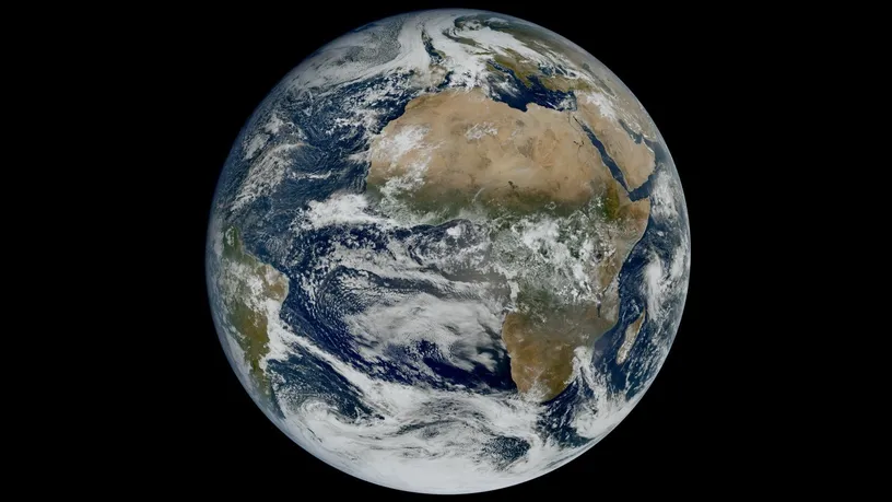
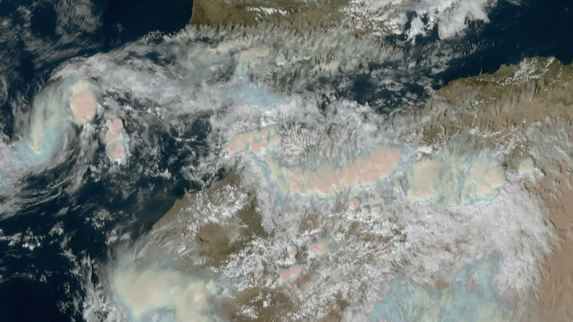
MTG-I2, the satellite Europe launched to watch its weather every 2.5 minutes, has sent back its first images. EUMETSAT released them on 6 November: a full view of the Earth’s disc that the satellite’s Flexible Combined Imager took on 20 October at 10:45 UTC, and an animation of Europe and northern Africa made of pictures taken 2.5 minutes apart over 45 hours from 3 November. They come just over two months after MTG-I2 was launched on an Ariane 6 from French Guiana on 27 August.
In this Article
- MTG-I2
Satellite
- Meteosat-12
Earth-watching satellite
- Meteosat-11
Earth-watching satellite
The satellite is not in service yet. EUMETSAT, which operates it from Darmstadt, is still calibrating and validating it with ESA and European industry, and expects its operational service to begin in the second quarter of 2027. “Just two months after launch, MTG-I2 shows us what rapid scanning will make possible”, said Phil Evans, EUMETSAT’s Director-General: “a much timelier view of fast-developing weather over Europe.”
What the first images show
The full-disc image, at the head of this Article, takes in Europe, Africa and the Atlantic from 36,000 km up: extensive cloud over northern Europe and the North Atlantic, against largely clear skies over the Sahara.
The animation is a preview of the job MTG-I2 was built for. It shows fog and low cloud lingering over central Europe, storm clouds developing over the Mediterranean, and clouds at different heights moving in opposite directions over the Atlantic. On 3 November it also catches the smoke from a wildfire in central Portugal. EUMETSAT has published two more animations from the first days of November: storm clouds building over the north-western Sahara on 3 and 4 November, and Storm Agneta, a deep Mediterranean low, bringing heavy rain to southern Italy on 2 November.
Why every 2.5 minutes
EUMETSAT splits its watch over Europe between two satellites. One photographs the whole disc of the Earth: Meteosat-12, the first imager of the new generation, does it every 10 minutes. The other scans only Europe and North Africa, and more often: today that is Meteosat-11, a satellite of the previous generation, which scans the northern third of the disc every five minutes from 9.5° east. Once in service, MTG-I2 takes over this rapid scan, with high-resolution imagery of Europe and North Africa every 2.5 minutes: twice as often.
Meteosat-11 and MTG-I2 both watched Storm Agneta turn over the central Mediterranean on 2 November: for every image Meteosat-11 took, MTG-I2 took two.
With a new picture every 2.5 minutes, EUMETSAT says, forecasters will be able to follow the overshooting tops of storm clouds, which can signal severe weather and are hard to monitor today, and to warn earlier of the heavy rain, hail, strong winds and flash floods such storms bring. The imager also sees detail down to 500 m in four high-resolution channels, and has channels made to detect fires and follow how they and their smoke spread.
Which Meteosat does what
MTG-I2 is the last of the first set of Meteosat Third Generation (MTG) satellites, and it joins a fleet that still includes three of the previous generation, Meteosat Second Generation (MSG):
- Meteosat-12 (MTG): Europe’s prime satellite since June 2025, photographing the whole disc every 10 minutes from 0°. Its latest image is on Earth Now.
- Meteosat-13 (MTG): a sounder, launched as MTG-S1 and in service since 13 October. Rather than photographing clouds, it measures temperature, humidity and trace gases down through the atmosphere.
- MTG-I2 (MTG): in testing at 3.5° east. From the second quarter of 2027 it takes over the rapid scan, and it will stand by as Meteosat-12’s backup.
- Meteosat-10 (MSG): Meteosat-12’s predecessor in the prime role, now its ready backup.
- Meteosat-11 (MSG): the rapid scan, every five minutes from 9.5° east, until MTG-I2 takes over. EUMETSAT has not said what it will do after.
- Meteosat-9 (MSG): watches the Indian Ocean from 45.5° east, until 2027.
Besides its imager, MTG-I2 carries a Lightning Imager, which detects lightning; the images released so far all come from the imager. From 2033, ESA says, a second set of MTG satellites is to be launched one after another to keep the mission going beyond 2040.
Where MTG-I2 is
Twelve days after launch, the satellite’s own engine had brought it to its final geostationary orbit at 3.5° east, ESA says, and EUMETSAT took control of it on 9 September. It has stayed there since, above the equator over the Atlantic off West Africa, turning with the Earth so that it always faces the same side of the planet. From there it looks down on almost the same face of the Earth as Meteosat-12, the satellite it is to back up, which keeps watch from the meridian of Greenwich, about 2,600 km to the west. Both can be followed on the live map.